Travel Tip: Helpful Site for Figuring Out Transportation Options Between Cities

Researching transportation options a couple of trips recently I’ve found myself coming back to a new (to me) site: Rome2rio.
Rome2rio shows you all your transportation options between cities with detailed breakouts and estimated costs, in some cases even the opportunity to purchase tickets directly, saving time.
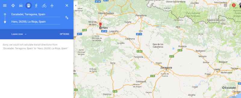
Usually I just use Google Maps (which doesn’t include cost) but for some destinations that wasn’t quite working. Like when my dad needed to get from Kiev to a small town in Romania. Google Maps only offered car and plane options. Driving wasn’t an option for him, all the flights had brutally long connections. I found Rome2rio when searching for possible train and bus combinations.
And now it’s helping me again in Spanish wine regions when debating whether to drive or take public transportation.
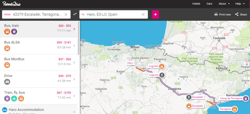
Google Maps could only help with driving.
They have information for 4,800 travel operations in over 158 countries including train, bus, plane, bike, even ferry operators. If your normal solution isn’t working, give them a try!

Nice app thank you for your posting .
Most bloggers write out the typical disclosure info but you are the first I have read that actually says…..
Thank you for your support !
Just come out with it and say it. I like that.
Thank you for your writing.
Robert